Every floor, built in 3D
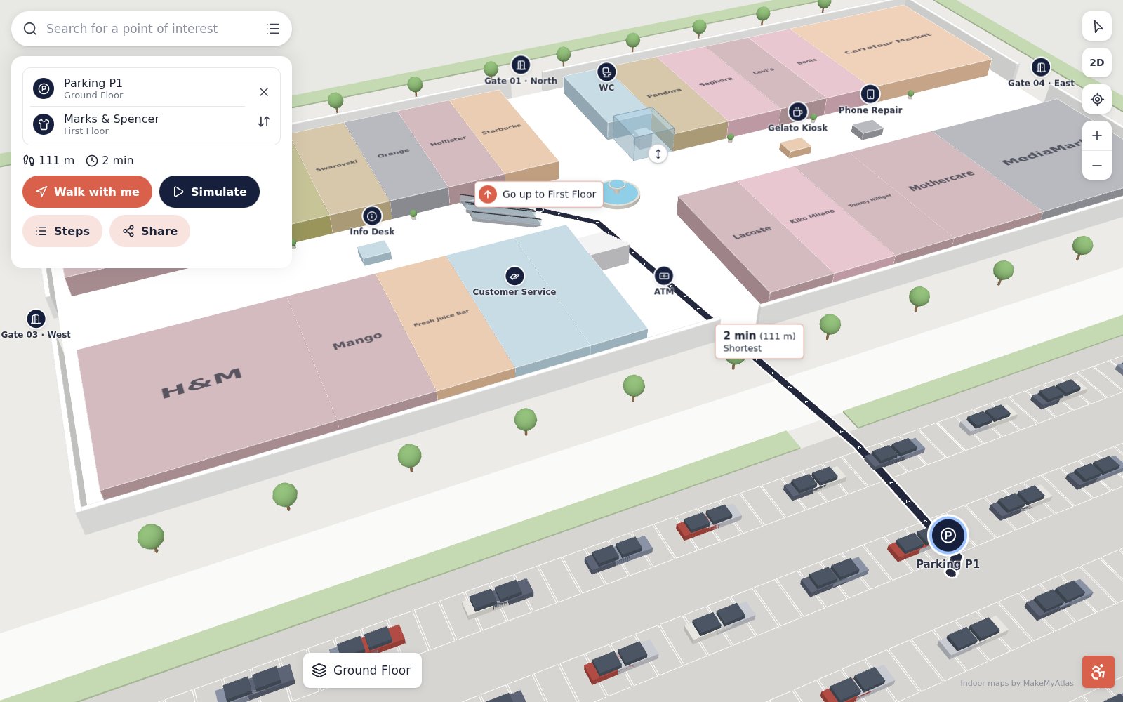
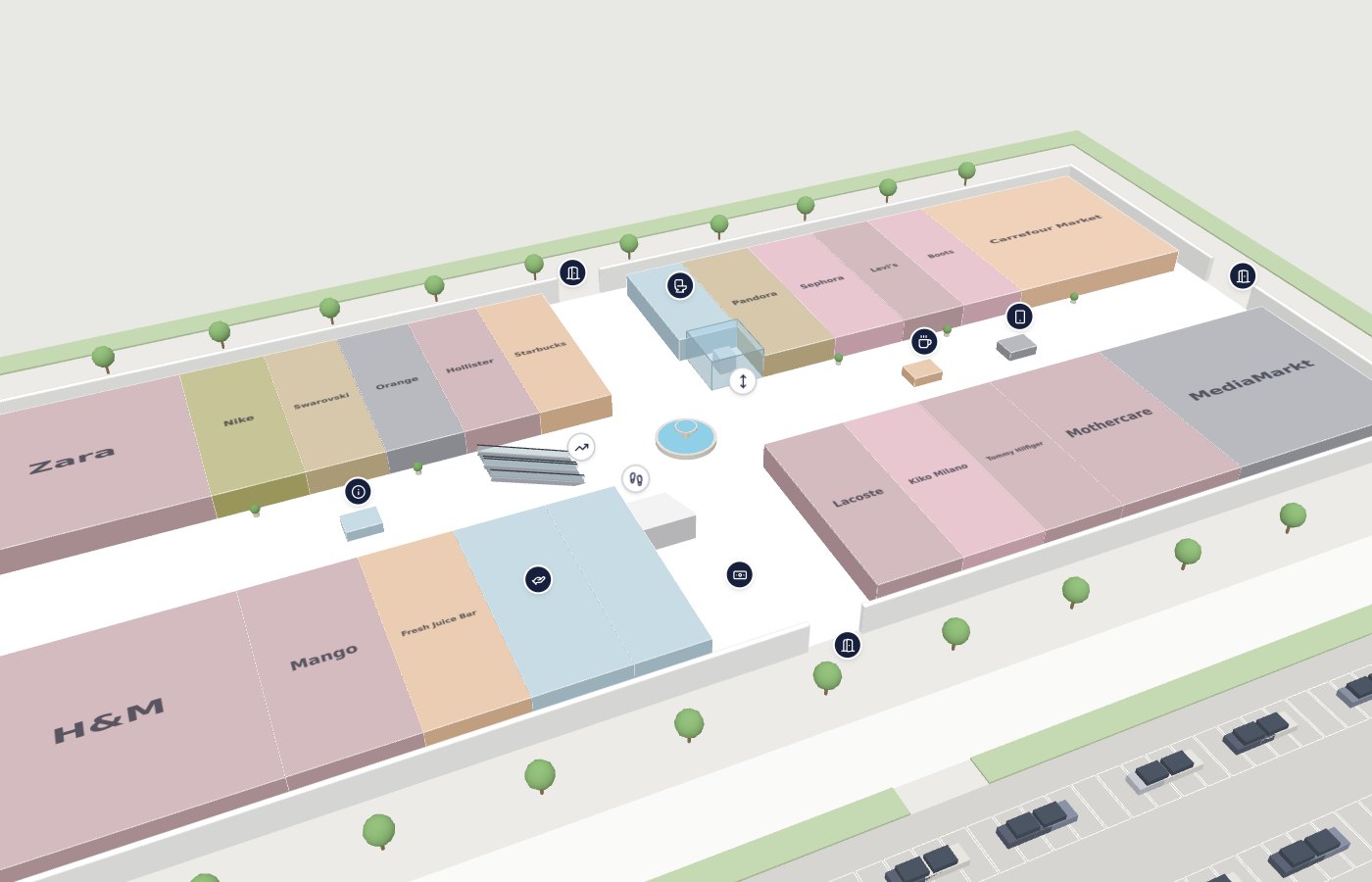
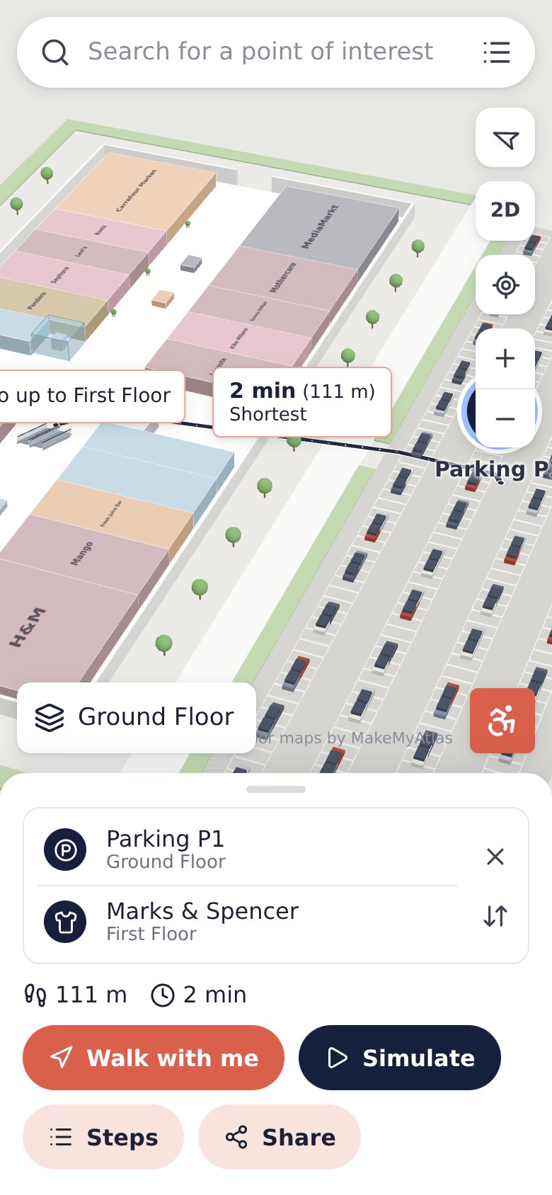
Shops rise out of the floor plate with their names on the roofs. Escalators, glass lifts, planters, food-court tables and even the car park are modelled — so the map looks like the place.
MakeMyAtlas turns your floor plans into a beautiful 3D map with turn-by-turn directions across floors — shared as a link, printed as QR signs, or embedded in your website and app.
Scroll — the live map on the right follows the story.
Shops rise out of the floor plate with their names on the roofs. Escalators, glass lifts, planters, food-court tables and even the car park are modelled — so the map looks like the place.
One tap fans the whole building out into a 3D stack. Visitors see how floors relate — which level the cinema is on, where the lifts line up.
From the car park to a shop upstairs: the route draws itself across every floor it touches, with glowing risers where you take the escalator or lift.
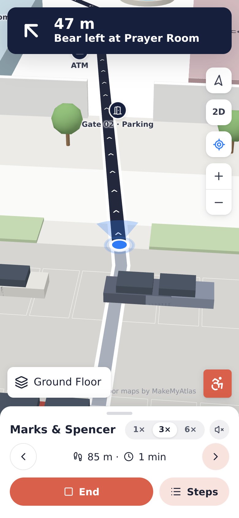
A cinematic preview follows the path turn by turn, rides the escalator between floors and lands at the door. Visitors know the way before they take a step.
Seating, counters and restaurants — every venue detail your visitors care about, on every level.
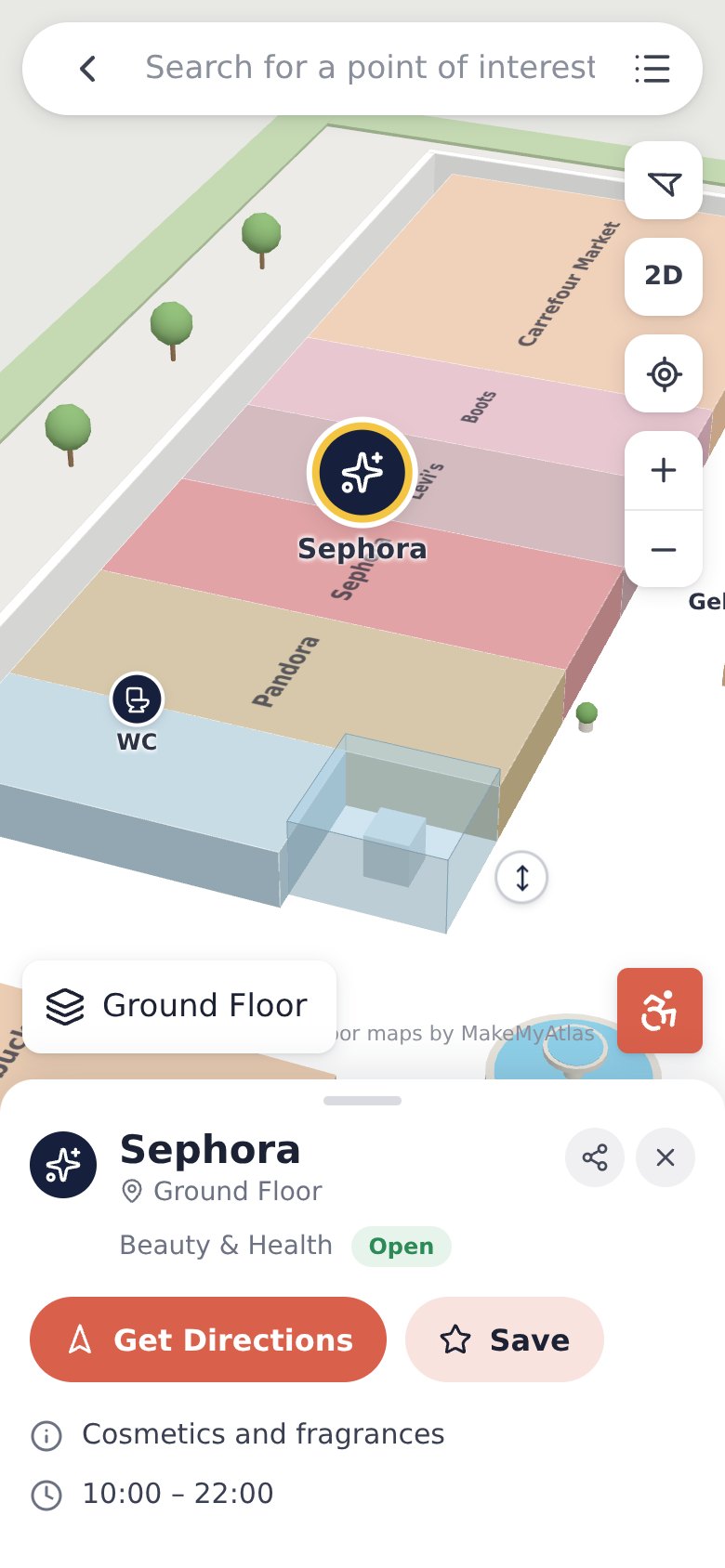
Search a shop, tap “Get Directions”, switch floors, then press Simulate to watch the turn-by-turn guidance.
The same polished experience on phones, desktops and kiosks — built to feel familiar from the first tap.
Extruded shops with names on the roofs, glass lifts, escalators, stairs, atriums, food-court tables, plants and parking — in your brand colours.
Routes that change floors by lift, escalator or stairs, with landmark directions like “Turn left at Zara”, arrival side and live ETA.
One tap switches to accessible routing that avoids stairs and escalators — essential for hospitals, airports and public buildings.
Category grid, sub-category chips, opening hours, phone, website and a place card for every shop, gate, ward or desk.
English, Spanish and Hindi out of the box; more on request. Remove our branding and use your own colours and domain.
No app to install. Share a link, print a QR code, or embed the map in your website, kiosk or mobile app.
Beacons cost money to buy, install, power and replace. MakeMyAtlas uses what every visitor already carries.
Printed QR codes at entrances, lifts and junctions open the map with the blue dot exactly on the sign — using the phone camera or the in-map scanner.
Visitors can simply choose their starting point, or pick a nearby shop as the origin.
Step detection and the phone compass move the dot along the route, snap it to corridors, recalculate if someone takes a wrong turn, and confirm floor changes at lifts.
Wherever people get lost, a clear map saves time for visitors and staff.
Help visitors find stores, food and parking; promote tenants on the map; place QR signs at entrances and car parks.
Guide passengers from kerb to check-in, security and gate, with walking times and step-free alternatives.
Reduce missed appointments and stress: patients and visitors find departments and wards on their own.
Meeting rooms, labs and facilities across many buildings — for staff, students and visitors.
Booths, stages and services on a map that can be updated right up to opening day.
Galleries, exhibits and amenities with routes tailored to accessibility needs.
You send what you have. We handle the rest.
Any format your architect or facilities team already uses, plus a tenant or department list.
Shops, corridors, lifts, escalators and amenities are mapped in the Venue Studio, and every route is tested automatically.
A print-ready sheet of “You are here” codes, one for each entrance, lift lobby and key junction.
A link on your own domain, QR codes, kiosk screens, and an embed for your website or app.
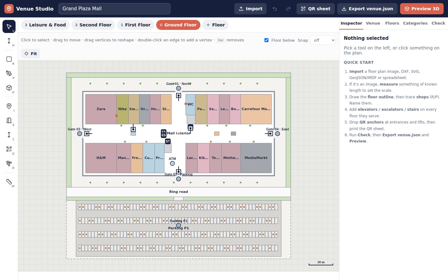
Whatever goes in, the same clean venue model comes out — so the map always looks and behaves the same.
Link straight to a store, a route or a floor. Add it to your website, your app, a kiosk, a booking confirmation or an appointment letter.
<!-- Embed on your website -->
<iframe src="https://makemyatlas.com/map/grand-plaza?wl=true"
        width="100%" height="640" allow="camera; accelerometer; gyroscope"></iframe>

<!-- Open a place -->
/map/grand-plaza?poi=S285

<!-- Route from the car park, step-free -->
/map/grand-plaza?from=P-parking&to=S301&accessible=1

<!-- Printed QR sign: "you are here" -->
/map/grand-plaza?at=Q-gate-n
No. Visitors set their position by scanning a “You are here” QR sign (or tapping the map), and “Walk with me” mode follows them using the phone’s own step counter and compass. There is no hardware to buy, power or maintain.
A QR scan puts the visitor exactly on the sign. While walking, step tracking is snapped to the route and corridors; it can drift over long distances, so we place QR signs at entrances, lifts and key junctions to re-anchor. For most wayfinding this is plenty — people need the next turn, not centimetres.
Whatever you already have: CAD drawings (DXF/DWG), IMDF, GeoJSON, SVG or PDF/PNG floor plans, plus a store or department list in a spreadsheet. We convert everything into one venue model in our Venue Studio.
No. The map runs in any modern mobile or desktop browser. You can also embed it in your website or existing app with an iframe or deep links.
Yes. The Venue Studio lets your team edit names, categories, hours and positions, check that every place is reachable, and publish the update.
For a typical mall floor with clean drawings, a first version is usually ready in days, not months — most of the time goes into checking names and categories with your team.
Send us a floor plan and we’ll show you a working map of your venue. No commitment.